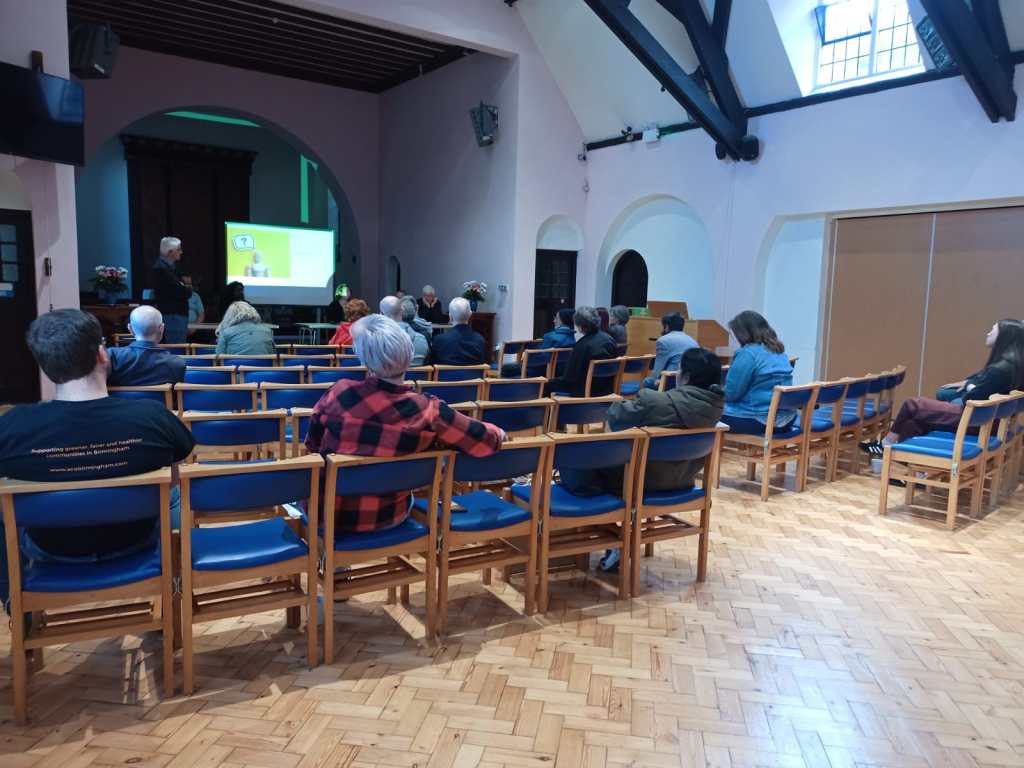
On 10 June the Kings Heath Neighbourhoods Forum organised a Home Energy Saving Roadshow at the Hub Hazelwell. The overarching aim was to point residents towards non-commercial local organisations that can assist with the transition towards cleaner and cheaper home energy systems that also promise an increase in comfort.
The evening had three parts, a presentation by representatives from local organisations, a general Q/A session, and time for individual advice.
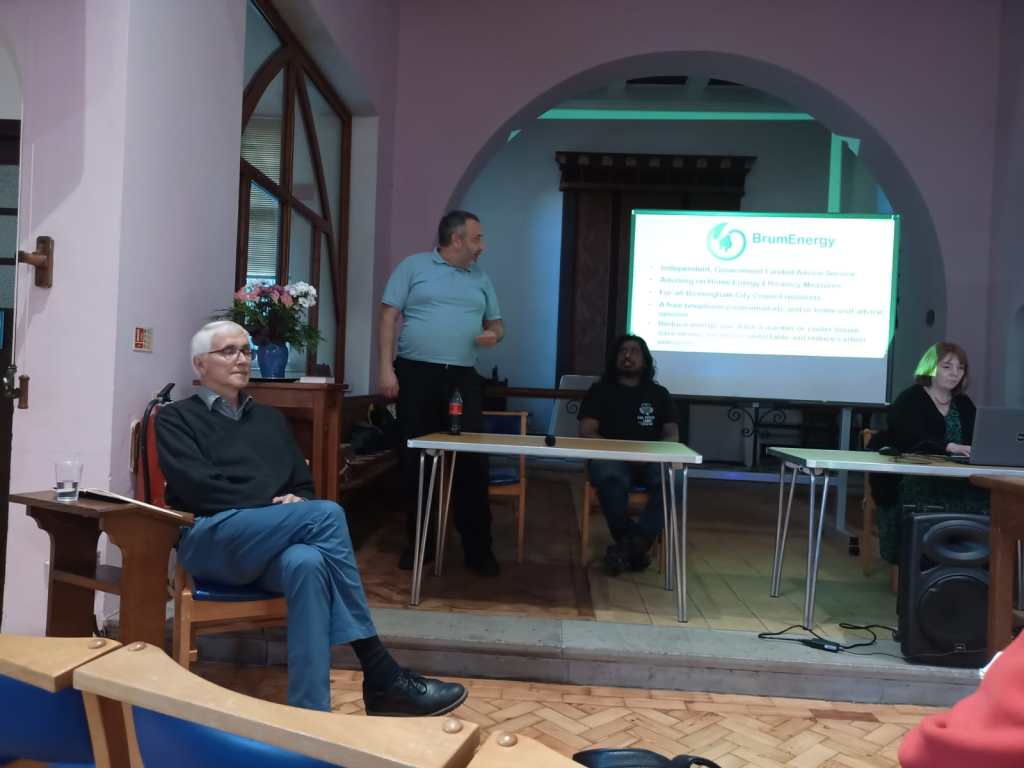
The presentations started with Tom Holness giving an overview of BrumEnergy, an umbrella organisation funded by various Government grants delivering free, independent, and high-quality home energy advice to Birmingham residents. 12 local organisations are contributing to this mission (of which three were represented at the event). Their website contains a wealth of advice and pointers to additional resources, but the main takeaway, perhaps, is their offer to provide a free personalised advice session.
Next up was Naomi Standen from ecobirmingham, talking about a range of simple measures that can help bring down energy bills, not just for owner occupiers but also for renters. Taken together, these “easy wins” can result in savings of over £500 annually in a typical household. A good starting point for reading up on this is this page on the BrumEnergy website.
Shaz Rahman from Community Energy Birmingham group spoke about more major interventions and upgrades that will keep your house warm, such as insulating walls. A major take-home message was to carefully plan the sequence of measures, such as improving insulation before changing a boiler for a heat pump.
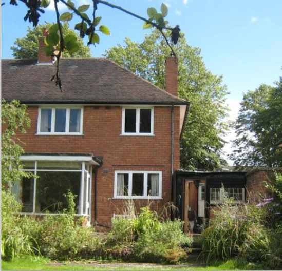
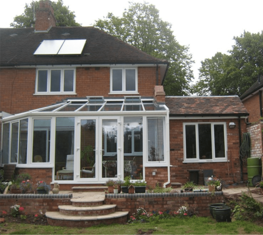
The final presenter was Chris Martin from Footsteps who told us how he converted a neglected Bournville Village Trust property into a highly energy efficient home for himself and his wife. It was nice to see concretely what it means to upgrade a house and to appreciate an outcome that is not only efficient but also aesthetically pleasing:
Some additional points were raised in the general Q/A session, such as the need to consider ventilation in addition to insulation, the main message being to make ventilation something that can be controlled by the occupants according to need, rather than relying on uncontrolled drafts.
In the final part of the evening, people were able to speak to the presenters on an individual basis, getting advice on specific issues that affect their home situation. For this, the participating organisations had set up stalls and brought along additional staff and volunteers, with plenty of freebies on offer to encourage conversations. An additional stand was set up by Joanne Exeter from the Brandwood Center advertising support offered by Cadent (the company that maintains our gas distribution network).
All in all, this was an evening packed with interesting and useful information, inspiring us to take the first steps in our own homes towards a carbon-neutral future.
Many of you will have received a letter from the Council about the latest consultation for the “Places for People” scheme in Kings Heath, also known as the Kings Heath Low Traffic Neighbourhood (LTN).
The consultation and documents showing the various plans can be found at:
The consultation is open until June 9th and we want to encourage people to submit their feedback to help deliver a scheme that works in the best possible way for the local area.
As part of the consultation there have been a number of focus group style meetings held and some of our committee have attended and made notes on a range of questions residents have asked. We’ve reproduced some of these here to help clarify some aspects so that people can submit informed feedback to the consultation. All this information should be treated with the caveat it is only our understanding of the information we have received, and only correct as of the publication date. The details of the plans are under constant review by the council and so things will inevitably change, please check the current information on the above website.
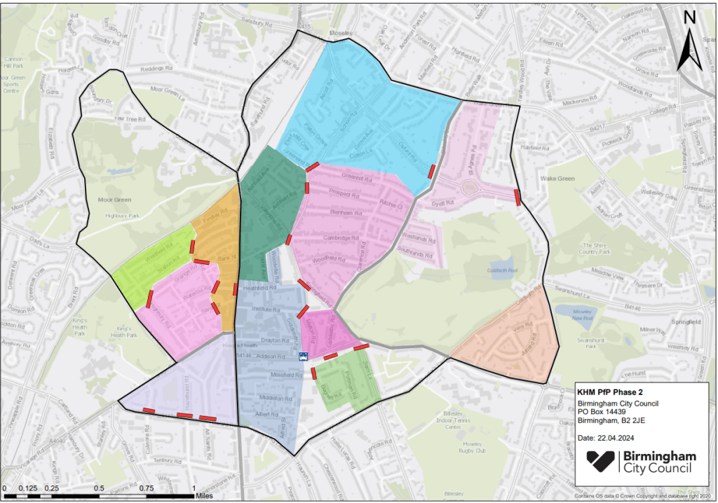
Map from consultation website showing the overall plans for the scheme
There are some important points worth clarifying about where we are in the entire process of the Places for People scheme:
The consultation is on the specifics of the design of the scheme, not on whether the scheme will go ahead
For the East side of the High Street a Traffic Regulation Order (TRO) will follow for the final designs, including changes made from these consultation plans to the final ones. This will involve a statutory consultation phase on the TRO
Many of the fine details of the plans (e.g. exact bollard placement, flow of traffic around zones) are not fixed at the moment, and will be decided based on the consultation.
The existing modal filters are “Phase 1”
Originally installed as an experimental traffic order during the pandemic
Made permanent in 2022 following further consultation phases
Existing arrangements of wooden planters and temporary signs will be replaced by fixed concrete bollards in conjunction with expansion works
The expansion is “Phase 2”
Consultation was held in 2021 on original plans and received 5000 responses
Plans were revised and targeted engagement was done in 2022, e.g. with residents on specific roads
Further consultation was held in March 2024
Now followed by current consultation
We’ve broken additional information down into the different zones to allow it to be cross referenced to the overall plan/map and the detailed documents on the consultation website.
Howard Road/Vicarage Road (Phase 1)
White on plans. Plans show amendment to current modal filter placement moving them to directly at Howard Road. This is open to change and is ultimately a choice between the current placement of the planters and the proposed location directly at Howard Road. With the former, there is a lot of illegal parking in front of the planters, especially school traffic. With the latter, there is the danger of drivers starting to drive across the pavement and grass to go around barriers. The council believes the problems with the latter can be addressed by additional barriers (e.g. low barriers alongside All Saints/Hazelhurst/Colmore Roads from Howard Road junctions to houses) so this is the favoured solution. If you can contribute further insight to this decision then that will be welcome.
Highbury Road/Grange Rd (Phase 1)
Pink on plans. Currently the filter at the junction of Highbury Road and Grange Road means a long stretch of Highbury Road which is a “cul-de-sac” for cars and goods vehicles. This is causing inconvenience for deliveries etc, and problems for large vehicles needing to reverse some distance. To remove the dead end on Highbury Road a diagonal filter will be placed to direct traffic right onto Grange Road. These filters mean the road is too narrow for two-way traffic so the section of Highbury Road from Silver St has to be one-way, as does Grange Road – effectively the use of a diagonal filter to solve the dead end issue on Highbury Road necessitates a knock-on solution of a one-way loop in this area to take traffic back to Highbury Road via Silver St. There is scope for revisions to the exact placement of filters and one-way streets, so check the latest documents and offer feedback.
Station Road/Westfield Road (Phase 1)
Lime Green on plans. As the other half of the diagonal filter from above this section will also need to have some one-way streets. The exact design of this is subject to change, and we believe there may be some updates/alternatives provided soon, so make sure to offer feedback if you have views.
West side of High St (Phase 1)
Yellow on plans. As with above areas there are some linked designs on account of the diagonal filters. The principle of moving the filters back a little from where they are currently placed in respect of the High St is seen as necessary to remove “cul-de-sac” arrangements that currently exist. However, the exact one-way system design (where needed) is not fixed and subject to the consultation. Existing Silver St filter (by Lidl) will stay the same, but replaced with fixed concrete/metal bollards. Residents have concerns on some of these streets (E.g. Station Road, Grange Road) about parking problems related to High St shopping and the new station. There are calls from residents for a parking permit scheme in this area, which is being explored.
York Road
Persistent vandalism of the existing bollards has led to a slight change which is already in place with new bollards at the top and bottom end and removal of some planters. In the expansion works these will be replaced with a fixed concrete row of bollards at the West end (near Grace and James), and a collapsible “coffin” bollard at the High St end which cannot be removed, and is opened by a key specific to this bollard which businesses will have. Meaning deliveries will only be able to access York Road from the High Street end, and only when let in by a business. There is a hope this can be covered by CCTV in the future. Closure at both ends is seen as necessary to prevent the rampant illegal parking which current blights the road. Residents seem keen for a true pedestrianised zone, however, there is not consensus amongst the businesses on York Rd to any limiting of deliveries, either to particular times, or to certain parts of the road, and so no prospect of a more extensive pedestrianised area, i.e. a zone which is entirely inaccessible to cars.
Valentine Road (Phase 2)
Dark green area on map. The existing Poplar Road Filter will be removed. All the streets in this area will be accessed from the High St side, with traffic returning to the High St. The roundabout at Cambridge Rd will be replaced by a diagonal filter meaning from Valentine Road at this junction cars can only access Poplar Road. Currently it’s proposed Valentine Road is one-way towards Poplar Road. [EDIT: Councillor Knowles from Moseley has let us know the one-way section on Valentine Road would start from Ashfield Road, and Valentine Road between High St and Ashfield would remain two-way]. Kings Heath School have been actively involved in focus group discussions around the details of the plans for this area.
Heathfield Road & South (Phase 2)
Light Grey area on map. All the roads in this area will be accessed from the High St, with traffic returning to the High St. Addison Road will have a “bus gate” (blue symbol on map) which will be enforced with an Automatic Number Plate Recognition (ANPR) Camera which will automatically issue fines for cars driving through it. Residents on Institute Road have been calling for restrictions to prevent speeding and reduce traffic for a number of years. Some roads in this area will be one-way, due in part to use of diagonal filters meaning the roads are too narrow at the junctions for two-way traffic, but also as some of the existing streets are barely wide enough for two-way traffic anyway. In the designs longer sections of road are generally not one-way due to concerns about speeding. Mossfield Road has a modal filter at the junction with Bagnell Road and is one of the few roads in the designs which is a dead end, requiring vehicles to turn around and return down Mossfield Road to the High St.
Barn Lane (Phase 2)
Green on map. This area will be access from Wheelers Lane. Original designs from 2021 were amended with consultation from residents of Barn Lane to have a modal filter on Barn Lane to prevent through traffic and speeding. This means access into the below areas from the South/High St end will be via Wheelers Lane, the Swan Corner roundabout by The Billesley and Brook Lane
Gaddesby Road/Melton Road (Phase 2)
Dark Pink on map. Accessed from Brook Lane/Springfield Road from the East, and Billesley Lane from the North, this will be a small one-way loop returning traffic to Springfield Road. This is the other side of the Addison Road bus gate, and so through traffic in the form of buses will pass through this zone from/to the light grey zone, but cars cannot drive through this area into Addison Road, or from Addison Road into this area without receiving an automatic fine.
Billesley Lane to School Road/Springfield Road (Phase 2)
Light pink on map. This large area will be accessed from Billesley Lane from the North and Springfield Road/Brook Lane from the South. Traffic coming from Springfield Road will only be able to access Cambridge Road or School Road at the existing roundabout. Instead, the diagonal filter that replaces the roundabout will mean that traffic from Springfield Road will only be able to access Cambridge Road or School Road (and vice versa). Traffic that proceeds along School Road in the direction of Moseley will only be able to travel as far as Greenhill Road before being directed down that road, which will take it back to Billesley Lane. In line with rationale described in Highbury Road area above the existing Cambridge Rd filters are replaced with the diagonal filter at the roundabout to remove need for vehicles to have to turn around/reverse down a long section of Cambridge Road.
School Road/Oxford Road (Phase 2)
Blue on map. This area can only be accessed from Wake Green Road.
St Agnes Road (Phase 2)
Light pink on map. This area can be accessed from Wake Green Road and Billesley Lane.
Billesley Lane (Phase 2)
This will have a 20 mph speed limit and traffic calming measures. A range of options have been considered and a series of “chicanes” are the current plan, which limit traffic to a single lane with signage indicating who has priority. These were the preferred option for the local councillors in Moseley.
General points of clarification
With the exception of the section of York Road which is currently pedestrianised the plans do not prevent access to any roads. They only add restrictions on where specific roads can be accessed from. The coloured areas on the map and referred to above are areas which drivers cannot drive through, they will have to return (typically) to the main road they entered the area from.
One-way streets will be contraflow for bikes – i.e. bikes can travel in both directions.
The fixed bollards will be similar to ones seen across the city to prevent through traffic, such as on Alfred Street/Howard Road. These will just be the physical infrastructure for now, but there is a general openness to improve these in the future, such as adding vegetation/sustainable urban drainage. The challenge is the adoption of such features in terms of responsibility for ongoing maintenance, where resident’s groups could have an important role to play in enabling these.
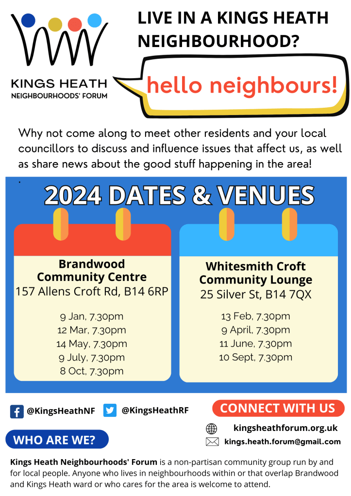
The dates have been set for our monthly meetings of the Neighbourhoods Forum.
Note: Meetings start at 7pm
Please note at the last committee meeting it was agreed to change the meeting start time to 7pm to improve accessibility. We will publish an updated poster soon with the correct time.
If you live in Kings Heath or Brandwood you are welcome to attend any of our monthly meetings as a visitor.